Fine Art Printery
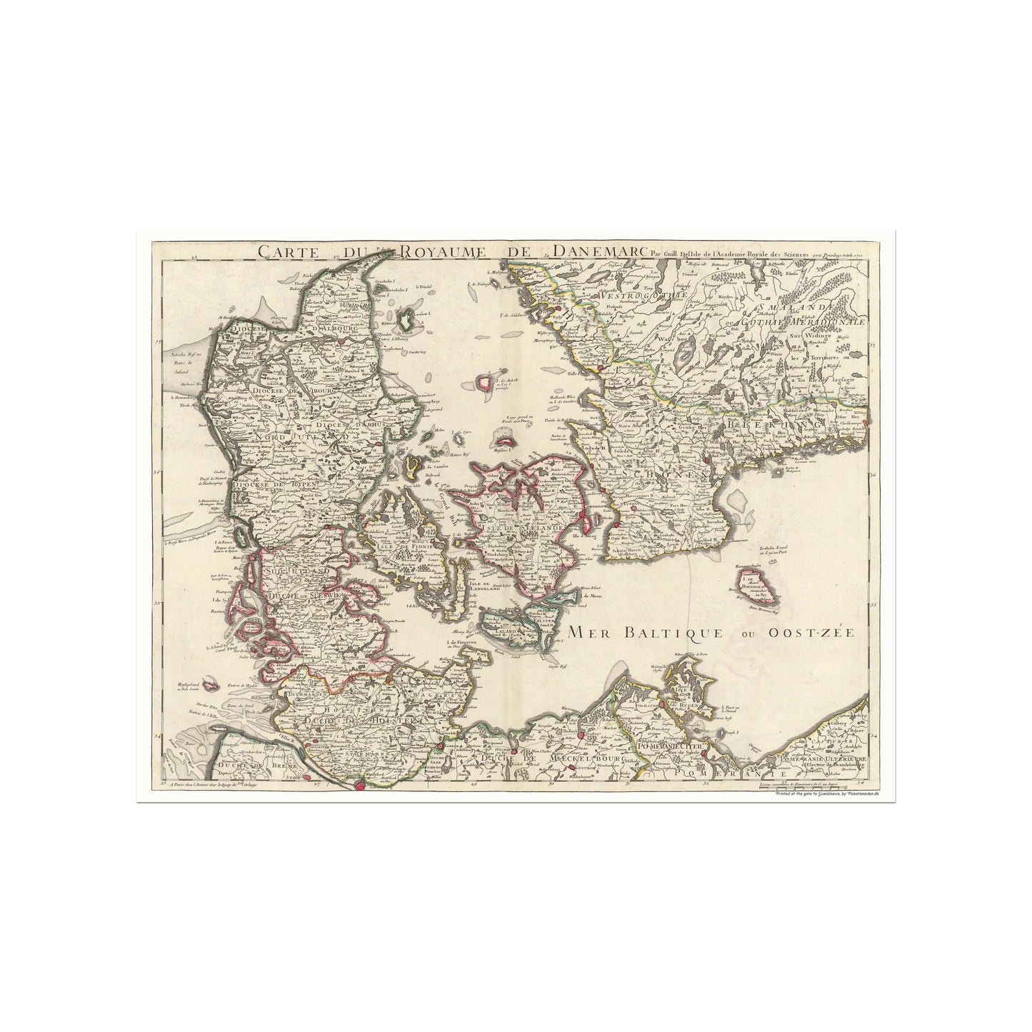
Map of the Kingdom of Denmark 1710
Map of the Kingdom of Denmark 1710
Regular price
199,00 DKK
Regular price
Sale price
199,00 DKK
Unit price
per
Tax included.
unless otherwise mentioned in the product description, frames etc. in the pictures are for decorative purposes only and are therefore not included.
Couldn't load pickup availability
The beautiful map of the Kingdom of Denmark, or as it is originally called Carte du Royaume de Danemarc. This fantastic map of Denmark from 1710 was created by Guillaume De Lisle. The map contains both Denmark, as well as parts of southern Sweden and northern Germany. The map is nicely detailed and in addition to showing a larger number of cities, it also shows, among other things, depictions of forests and hills etc.
The original map was made during the Great Nordic War, a time when the Swedish Empire, led by an inexperienced king, Charles XII, was facing challenges. Peter the Great of Russia saw an opportunity to gain access to the Baltic Sea and the Black Sea, so he joined forces with Denmark-Norway and Saxony to declare war on Sweden.
Guillaume De Lisle's masterpiece was included in the Atlas de Geographie, showing his talent and attention to detail. It is a true work of art that captures a significant moment in history.