Fine Art Printery
Vintage North Sea Map by Frederick de Wit (ca. 1690) - Antique Nautical Chart Print
Vintage North Sea Map by Frederick de Wit (ca. 1690) - Antique Nautical Chart Print
Couldn't load pickup availability
Embark on a Journey Through History with This Stunning 17th-Century Nautical Chart
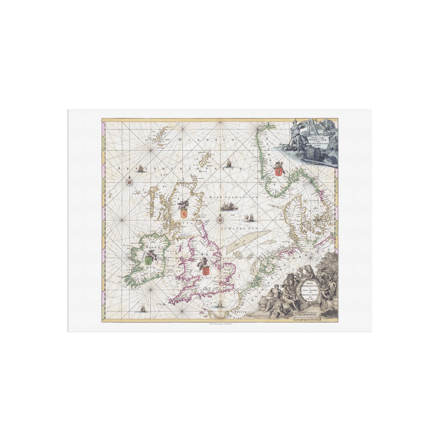
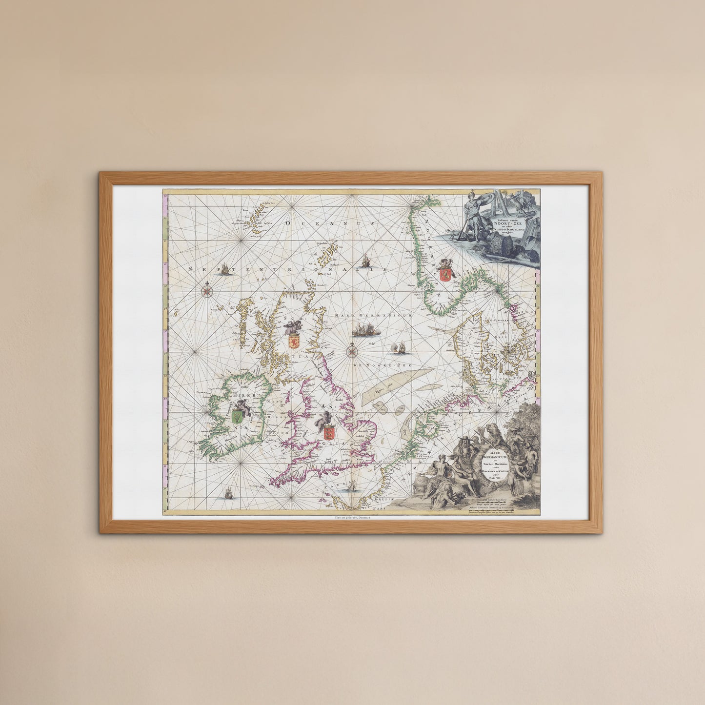
Adorn your walls with this extraordinary vintage map, a faithful reproduction of a masterpiece by the Dutch cartographer Frederick de Wit. Titled "Mare Germanicum," this engraved, hand-colored chart from Amsterdam, created around 1690, is a perfect reflection of the Dutch Golden Age of exploration and trade.
Why This Poster is a Must-Have:
-
A Masterpiece of Art and Navigation: This map is more than a historical document; it’s a work of art. It meticulously details the regions around the North Sea, including the coastlines of England, Scotland, and Ireland. Essential navigational features like rhumb lines and sea routes are depicted with precision, showing the importance of maritime trade during this period.
-
Unique Artistic Technique: This is of course a printed reproduction, but the original map is distinguished by its use of grisaille, a technique using shades of gray to create a sculpted, three-dimensional effect in the decorative cartouches. This artistic choice, combined with the detailed heraldic shields and hand-coloring, gives the map a remarkable visual depth and a classical aesthetic.
-
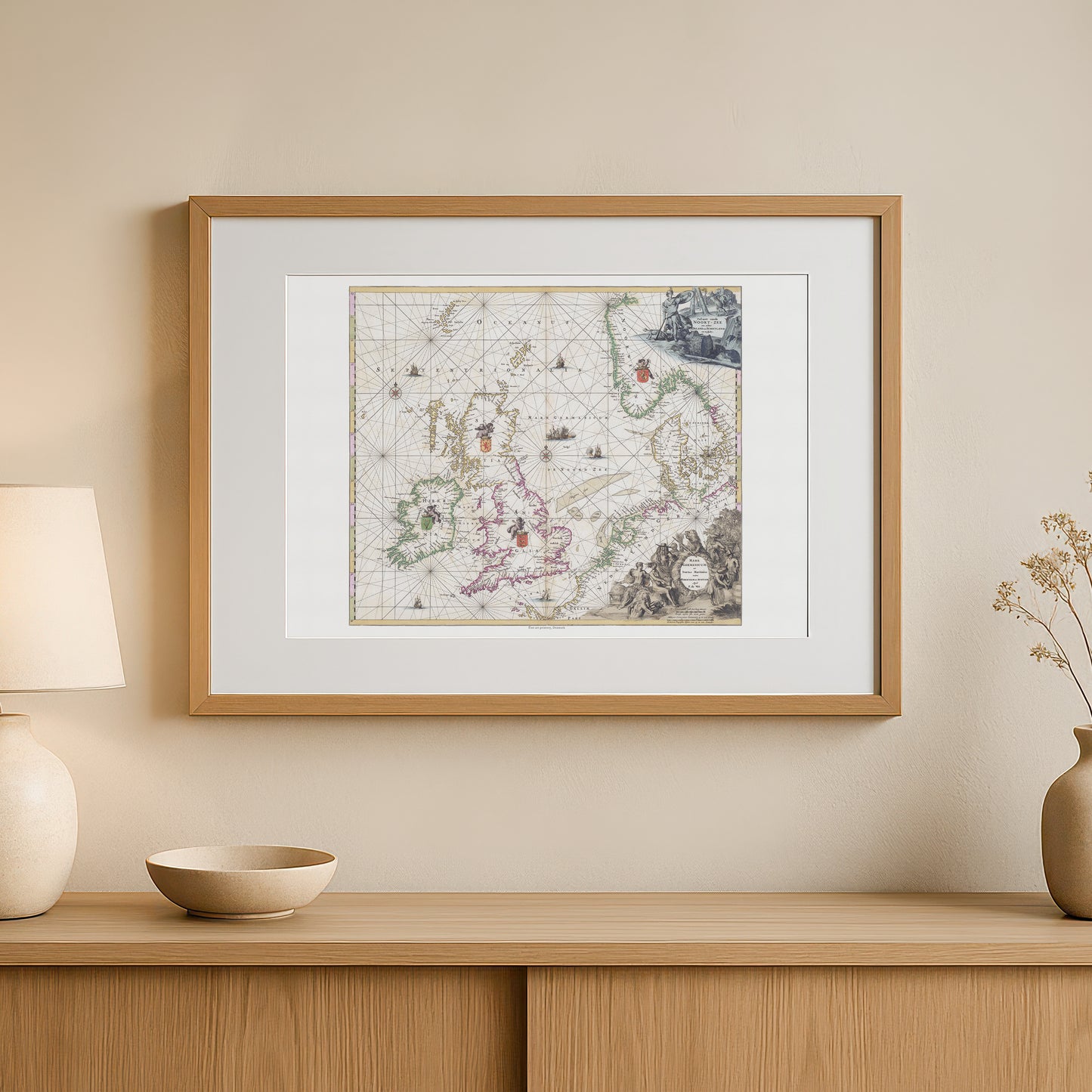
Elevates Any Decor Style: Its rich colors and intricate details make it a stunning focal point in a variety of settings.
-
For the Office or Study: It adds a touch of historical gravitas and intellectual curiosity.
-
For Coastal or Nautical Themes: It's a sophisticated way to celebrate a love for the sea.
-
For Eclectic and Traditional Spaces: It's a timeless piece that blends beautifully with classic decor.
-
Please note: This listing is for the poster only (frame not included).
Share